
The following overviews my independent research using geospatial technology:
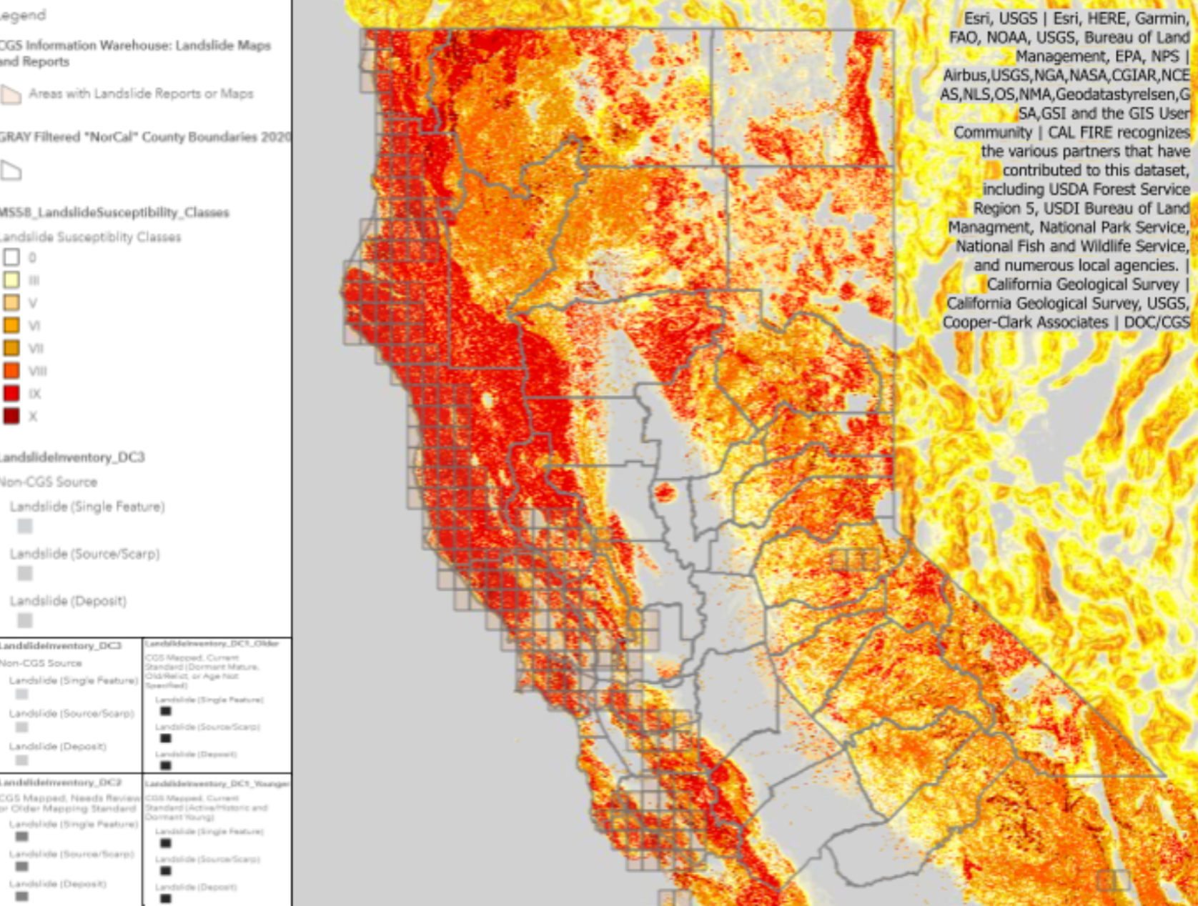
Investigation on Californian mudslide susceptibility with consideration to precipitation rates and terrain steepness post-fire.
Research Question
To what extent do precipitation rates and terrain steepness affect the susceptibility of Northern California mudslides post-fire?
Null and Alternative Hypotheses
H0: If a new wildfire hits Northern California, then it will be more prone to mudslides than in previous years because of lighter precipitation rates post-drought.
H1: If a new wildfire hits Northern California, then it will be more prone to mudslides than in previous years because of heavier precipitation rates post-drought.
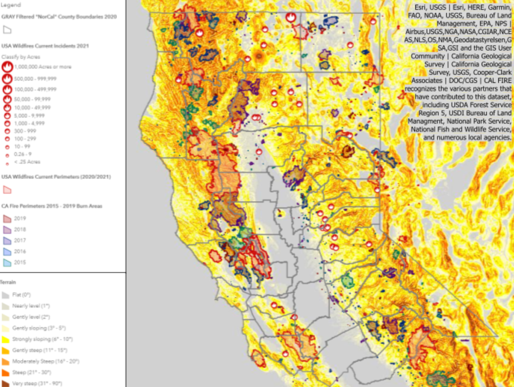
Control: Water Years (WY) of Northern CA
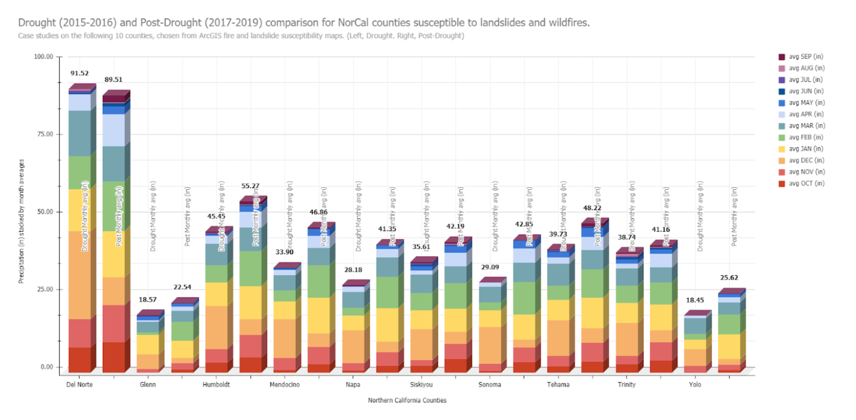
The precipitation rates and the terrain will be taken into account from Northern California in the years 2015 and 2016 (During Drought).
The control is essential in contrasting the shift in wildfires and landslide susceptibility from drought to post-drought CA.
Experimental: Consecutive Water Years (WY)
The precipitation rates and the terrain will be taken into account from Northern CA respectively for each year between 2017 and 2019 (Post-Drought).
Data Critique
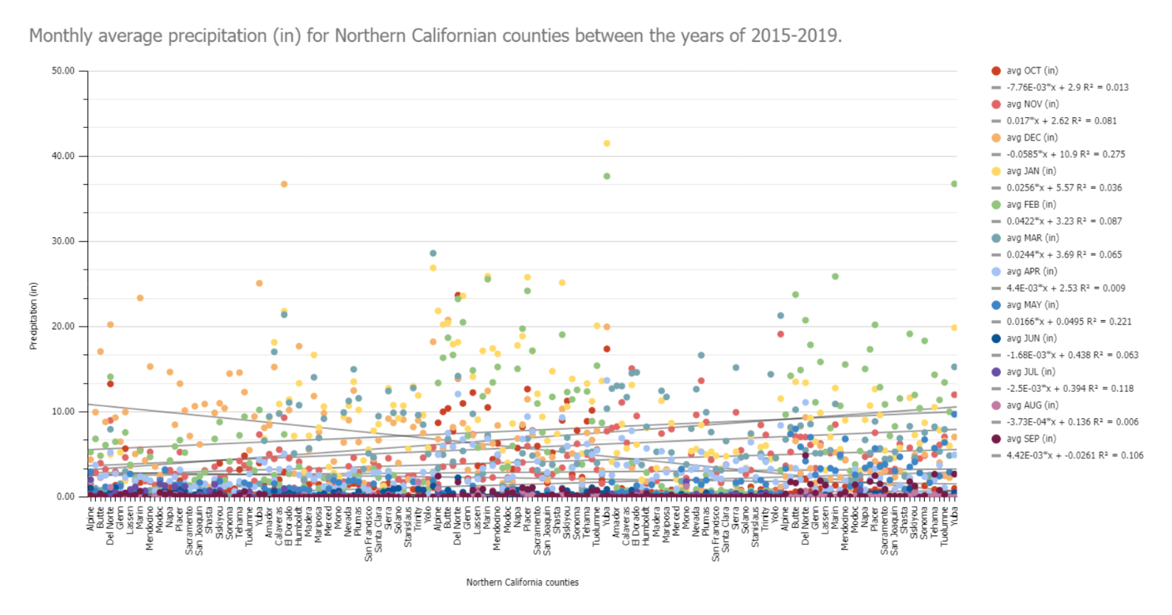
The most egregious instance for [missing information] is the precipitation data (Appendix B). Initially, I needed data from 2015-2020, yet the entirety of 2020 was missing or inaccessible. [...] water stations like the East Park Reservoir would be recorded for only one year [...] As advised, I removed those to not skew the data. It can be inferred that due to the previous American administration (Plumer, 2019), the missing precipitation data could have been lost due to political interference.
Future Modifications
If I would re-investigate this research question, I would include vegetation density and biomass data as a point for comparison compared to the terrain.
Vegetation, responsible for stabilizing the land, is significantly more susceptible to wildfires per year than yearly changes in terrain.